FITS Deprecation Notice.
The FITS data base is being deprecated on the 31st March 2025.
The data is being migrated to Tilde and will be available through the API and visualization interfaces.
You can check on the status of the different data sets on our FITS System Deprecation: Transition to Tilde API page.
Tsunami Gauge Network
About GeoNet's Tsunami Gauge Network
New Zealand’s tectonic setting in the Pacific puts us at risk from many different tsunami sources, some may be generated and arrive at our nearest coasts in less than an hour.
To help our experts, we have the Tsunami Gauge Network which is used with the DART Network to monitor and assess the hazard and risk of potential tsunami around New Zealand, Raoul Island, and Wharekauri Chatham Island.

Installation of Tsunami Gauge at Fishing Rock on Raoul Island.
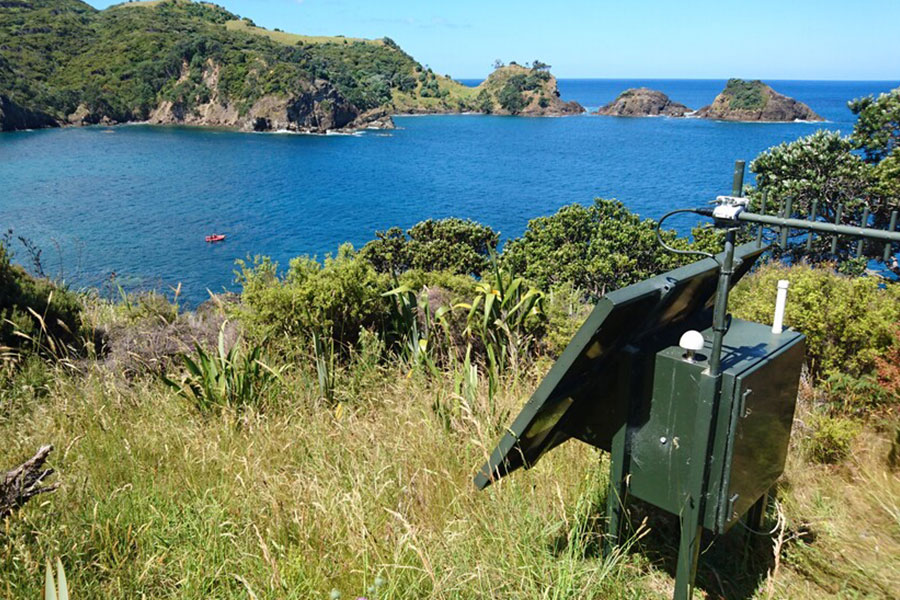
The electronics and radio equipment used to transmit the tsunami gauge data on Great Barrier Island.
NZ DART Buoys - tsunami detection technology
GeoNet's Ask An Expert - The Tsunami Edition - Compilation
Partnerships
The Tsunami Gauge network has been made possible by funding from Toitū Te Whenua LINZ. Data infrastructure, management, and dissemination is supported by the GeoNet programme.
Get tsunami ready: Know the natural warning signs and take action
For a local source tsunami, which could arrive in minutes, there won’t be time for an official warning. It is important to recognise the natural warning signs and act quickly.
If you are near a shore and experience any of the following, take action. Do not wait for official warnings.
- Feel a strong earthquake that makes it hard to stand or a long earthquake that lasts more than a minute
- See a sudden rise or fall in sea level
- Hear loud or unusual noises from the sea
Drop, Cover and Hold during the shaking. Protect yourself from the earthquake first.
As soon as the shaking stops, move immediately to the nearest high ground, out of all tsunami evacuation zones, or as far inland as you can.
Remember: Long or Strong, Get Gone.
NEMA have a great website with information on what to do before, during and after a tsunami.